So I went next door, and even though it was lunchtime, a guy came out immediately and said he would check my tires and make sure they were right. Less than 1/2 hour later, the guy was back with my truck, telling me that he had set them as per the manufacturer, and when I asked about the pressure that Tire Rama had jotted down, he scoffed. He told me that they had all been with a few pounds of each other and that they were all in the 60's. The service manager said that they had a customer that went to them and they said they needed tie rod ends, and they had JUST been done at the dealer! In my gut I KNEW that this guy had probably used the gauge wrong. Heck, that high amount of a difference would have shown when you look at them! Anyway, I asked for the bill, and was told NO CHARGE!!!!!!!
So, if you are even in Sheridan, Wy, don't go to TireRama, but DO go to the Dodge/Jeep dealer on Coffeen Ave!
I went to one of the local banks to cash my check. They were pleasant, and COUNTED MY MONEY BACK TO ME IN FRONT OF ME! What a shock! No one counts $$ back to you anymore!
By the way, there is this incredible mural over the teller's heads that is huge, maybe 30 plus feet wide. It was painted in the 1950's and still looks like it was done yesterday. It shows the pioneers coming to Wyoming. (which is a theme for a lot of art in Wyoming). NICE tellers. Check out First Interstate Bank on South Main in Sheridan.
I then went to pick up something I had put aside, and headed west toward Cody. I had originally thought of going North to the Little Big Horn, but I was there before, so I figured Custer was there, I didn't need to be.
Before I left, I took a ride by the famous Sheridan Inn. Buffalo Bill Cody himself sat here with his partner and worked out the details to start the town of Cody, Wyoming. This hotel is known for great food and is also known as a very haunted place in Wyoming. Regretfully, I did not have time to explore it and see if I found any spirits there.
 |
| Historic Sheridan Inn |
 |
| Bill planned the Town of cody from a booth in the INN |
To go west you need to go north on 90 first, and the Acme, Wyoming area along the Tongue River, is just gorgeous! Pretty little houses, a nice river, lovely trees along the banks, a nice winding railroad track. There are red cliffs that ring the valley the river and tracks run through, and those lovely big Horn's are off to your left. The only problem is the wind that you can feel pushing the truck. Heck, this is a windy state also. I swear, the entire west is windy.

I hang a left onto Route 14, a major route to Yellowstone and The Tetons. I now go through another pretty town, Ranchester, only 3775 feet above sea level. Not much there, a closed diner, but nice neat little houses, the river, the trees, the tracks. But it does seem to be a place that log home builders like to situate themselves in.
When I stop at a historical marker, I join a couple in a camper. The plates read Saskatchewan! And they are standing on the side of the road sipping red wine from tiny glasses! And did not speak English.


As I pass through Dayton, Wyoming I spy the "Crazy Woman Saloon." No, I do not own a bar in Wyoming, I happen to know that there is a river by that name, so it was not named after this crazy woman.
Listening to the radio that tells of local road and weather conditions, I hear that route 14 is still closed around Greybull because of a rock slide. I had heard that it was, but it still is, and I hear that it is indefinite. So I plan to take 14A.
The wind is still pretty swift, and I watch it move the high grass on the sides of the road and the fields. It is interesting to see it move along in waves, and change colors depending on the side of the leaves that are showing. One of those simple little acts of nature that are fascinating to watch.
I am on 14 and start to climb. The road is basically a snaky road that is all switchbacks, and (almost) hairpin turns. And, you can tell we are climbing, even though with the way the road keeps going back on itself, it does not seem that way. In fact, there are signs all over the place that warn trucks, and RV's that the road it tough on them and that they need to pull over at certain place and HAVE to read the signs!
 |
 |
| HELLO?????? |
I see signs along the way, announcing the era and age of the rock formations. I see one for 280-325 MILLION YEARS OLD! As we climb we pass back into the Big Horn National Forest. There are signs that say you need a permit to cut firewood, and even see people on the side of the road doing so. I heard before that as a resident, you can cut a certain amount of firewood each year. I think it has to be downed stuff. When you think about it, this is a great way to get the downed stuff cleaned up and it ends up being less fuel for the wildfires that do come through periodically.
I think I am almost to the top and I am now seeing 345 MILLION YEARS for rock age! Can you imagine anything that old??????????? (No, not some of your relatives or things that sit in the back of your closet or refrigerator)
I pass an area called the "Fallen City." It is a group of granite rocks that look just like fallen walls or buildings. It is pretty neat. In fact, right after that I find rock formations that are 430-500 MILLION YEARS OLD! Unbelievable! I am also starting to see some snow along the fences and under the trees up here. I pass a place that is called Cutler Hill and announced that it is 8347 feet in height. That would make it only a little bit higher than TP was (which was like 7800 I think) but it sure felt like I was going pretty high.
 |
| Rcok City - see the fallen rocks? |
So sitting way up here in the mountains is Sibley Lake. A lake? That's really interesting. There is also a camp up here, called Camp Bethel, and I see a bunch of kids and a school bus at a building! I sure would not want to the be bus driver on that trip!
There are several National Campgrounds, Prune Creek, Arrowhead Resort. I get to Burgess Junction, and the split of 14 and 14A, and I turn onto 14A. When I started out this morning in Sheridan, it was a great sunny day and in the 70's. Right now, when I take the split, the temp on my truck is reading 55 degrees.
I follow the Tongue River on my left, which is running high and fast, even up this high. I keep hearing that the snow melt is starting to go fast, and that is running the rivers. And very late in the year for it. I start to see some pretty deep looking snow in the ravines, some even covering the fences in that area! It is now down to 45 degrees.
 |
| Hmmm - snow ?? |
I see signs that this is Open Range. That's kind of funny, since the temperature is down to 43 degrees, and there is the left over of the snows that was plowed over winter. In some areas, the snow bank on either side of the road is HIGHER THAN MY TRUCK! There was a car and a family that was pulled over by some of these banks, they were out of the car and wearing shorts and t-shirts, and taking picture next to the snow banks! This is really surreal. If you look at state maps, this is the area that is impassable in winter. No kidding! I wonder how they got through to plow this so that it is not passable. After all, they only plowed the road into TP around the 5th of June.
 |
| Hmmm - more snow? |
 |
| And more |
I hit Bald Mountain. There is a snow track vehicle sitting on the side of the road on top of all this snow! Believe me, they need it up here! Regretfully, I do not see a sign that shows how high we were at any of those times when the snow was so high. Maybe it was UNDER the snow still? I can see the very tops of some signs, like speed limit ones. I know that this section of road is closed in the winter. Smart move. I wonder how big the plow has to be to go through this. I am assuming that they just plowed this road within the last few weeks like they did the road up to TP and the Big Horns in that area.
 |
| And more |
 |
| What the bajeezes! This is snow!!!!!! |
 |
| Yep, in the end of June |

I crest the mountain and start down the other side. To see signs that announce at 10% GRADE! Yep, that is steep. The speed limit on the road and switchbacks are 25-35 MPH and there are run away truck turn outs everywhere. When I finish sliding down this side of the mountain, it has taken me maybe 1/2 hour tops, and I am now at 72 degrees. I hit the bottom of the canyon and the Big Horn River and it is 78 degrees. This road is what is called the Big Horn Scenic Byway, and scenic is certainly has been.
 |
| Dropping many feet in a short time and the temperatures rising |
Along my route I see bentonite plants in Lovell, (population 2300 or so) farmland, growing corn and a whole lot of junk metal. Why is it that when you see older farms you always see junk metal???
One thing I do is take the side road that leads up towards Montana that passes through the Pryor Mountain Horse Reserve. It is common to see the band of wild horses that roam there from the road, but not on that day. I travel several miles, along with a couple other vehicles, looking for the band, but none seem to be willing to show themselves to us. What I find interesting is the poor quality of land that these horses roam on. I wonder how they can find any food at all, even in June with lots of water that has been available this year. It appears top be all scrub bush, sagebrush, rock and sand.
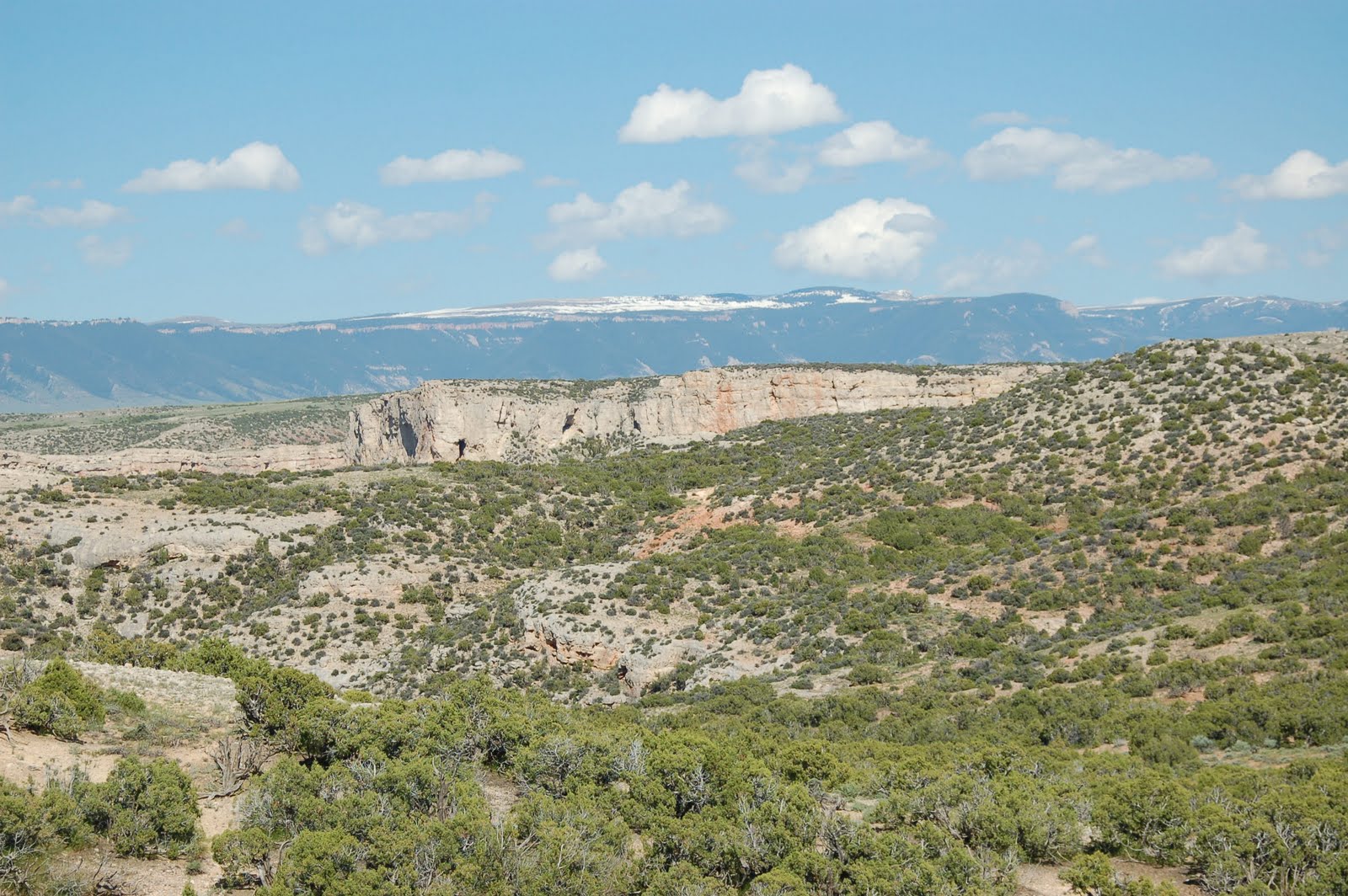 |
| Don't know how horses can find feed in this |

I pass through Byron, (200 people or so) where you see the oil drilling and can smell it too, Garland (which only has 50 residents) and is farmland, and pass the Jim Bridger Trail. He was an explorer that went up into Montana. When I hit Powell (5373 people!) where they have a Homesteader Museum and the rail road tracks run along the side of the road.
The people of Powell will not be happy with me, but it struck me as a pretty grubby town. Run down, not attractive. But it had the old Corbitts Stage Station and is the home of the current "Cody Trout Ranch."
Cody, now that is a different town. Only 8835 people and at 5016 feet above sea level, it is about the same height as Denver. Way different town than that. Heck, there were PBR trailers in the Holiday inn parking lot. A word of warning, the hotel and motel rooms in Cody are quite pricey. I think the lowest I found was about $125 or so, this being peak summer times. I think winter you can get around $50.00 but not now. So, I went further out, and got a room at the Oasis Motel in Meeteetsee, which is south of Cody. $45.00 a night, and it's family run, with microwave and refrigerator in the room. Quiet, comfy and two double beds. Well worth it. Cell service, very spotty, but nice clear wireless Internet.
Tomorrow I explore Cody. Can't wait!
No comments:
Post a Comment