|
| You follow the Rockies on your left |
 |
| Sculpture at the Colorado welcome center |
It's a little after noon when I cross the border in Wyoming. I have been following the Rockies on my left for some time, and even stopped at a Colorado welcome center and found a surprise along with my pit stop, beautiful art! I find that here in Wyoming, like Colorado, there is no rule that you have to wear a helmet when you ride a motorcycle. While I can certainly agree with the free spirit sentiment, I think that's just dumb!
I slide into Cheyenne, and find an older city with much improvements being made. It is a 'happening' city, and it, like others I was to find out, comes up with ways to make it interesting, and to bring people into it's downtown. This was a street fair with bands, a 'refreshment' area, and vendors showing or selling wares or services. I took a little time to visit some of the local stores, and tour a bit of the city, stopped in a western wear shop. As cities go, I was very impressed. No too big, not too small, not too dirty, all the things you want, and a nod towards the arts and it's history. I thought it was a very nice city.
 |
| Lew Taubins Western store |
 |
| Street Art |
 |
| A nod to the Past |
 |
| Nod Number 2 |
I'm heading west out of Cheyenne heading for Laramie. Along Route 80 are interesting sites: a billboard proclaiming the town of Bufford, Wyoming to be the smallest town in America. Population: one. Rolling plains, drilling rigs, here you know it's for oil and natural gas, and wind turbines.
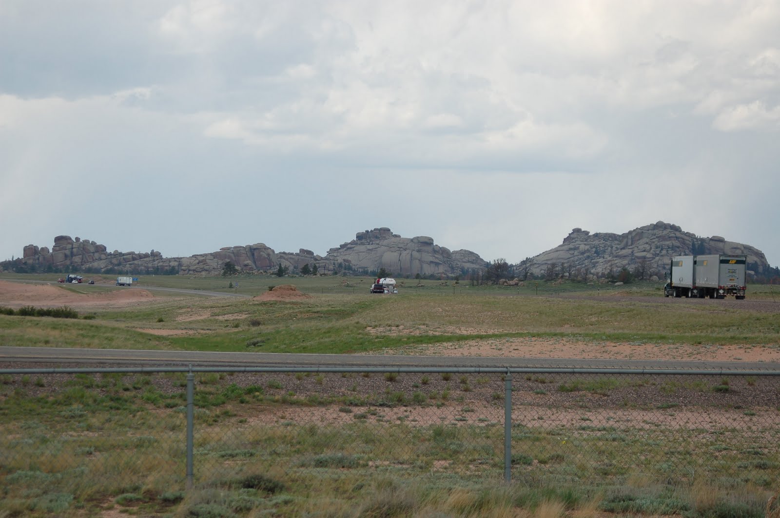
I travel along the Laramie Range and parts of the Medicine Bow National Forest. Along the way is a rest stop that is the highest peak in the Laramie Range, at 8835, and the highest part of of the old Lincoln Highway, the first highway across the country. These are the Sherman Mountains.
 |
| Summit Mountain |
Along the way is an interesting sight, something that has survived for who knows how long, as it was here when the railroad came through in the 1868's, in fact, because of it, the railroad relocated it's track. It is a tree growing out of a rock. No kidding. It was a famous stop on the Lincoln Highway. It is a type of pine that is said that can live 2000 years! The rock is pre-Cambrian that is said to have been formed over a billion years ago. So, what do you think about this rock and tree?
 |
| How old do you think this tree is? |
 |
| Look at the roots embedded in the rock. How is this possible? |
Traveling west on Interstate 80 I re-enter the Medicine Bow Forest, and find that snow is still in the shadows of the snow fencing along the highway! The signs warn or a 5-6% grade here, as we cut through mountain passes and then drop into the valley below. A beautiful sight as we descend into Laramie. As is typical of the prairie, there is all sorts of weather both above me and in the distance, I get a mix of wind, rain and sunshine, bright blue sky. It is truly amazing. filled with formations of yellow and red rocks, snow in the distant mountains, clouds dropping darkness into the valley, and not much here, vast open spaces of high plains, and another flooded river, this time the Laramie River.
I am following the trail of the Sand Creek Massacre from Cheyenne to Laramie, when in 1864 a group of soldiers from Colorado attacked an Indian village of Cheyenne and Arapaho Indians. The problem was that the village was made up of women, children and old men, which they killed an mutilated. Another shining moment by the US Armed forces.
I take a side trip to the Wyoming Territorial Prison just outside of Laramie.
This prison holds the dubious notoriety as being the only prison that held Butch Cassidy. Plus it also held a fair amount of women for all sorts of real or imagined crimes. Seems back then, some women were convicted of crimes that were a farce, like someone ended up dead and they just happened to be the housekeeper. However, I found it interesting that some of the sentences that people were to serve for things like murder were maybe a decade? I did not see any life sentences. Heck, if you got that, you probably were hung first.
 |
| Cell Block |
 |
| Lovely accommodations, how would you like to be here in summer? |
 |
Step right up for your medical procedure.
Yeah, right! |
By the way, this place is supposed to be haunted, but I found nothing there. Oh well, can't see them all!
I cross and recross the Laramie river a few times, the flooding is still pretty bad here.
 |
| Flooding |
 |
Apparently road closing are a common thing here, these signs are all over the place
These signs ARE to be taken seriously! |
Onward I traveled, north west towards my next destination. I passed through the town of Bosler, an abandoned town and on the abandoned town list. Was supposed to be spooky, but it sits on the highway(such as it is), and it had a school building that looked like it was 60's for criminies sake, so I don't buy too spooky here.
 |
| Any spooks here? |
 |
These looked good enough to run!
|
Along the highway is a small cabin and a big sign. Seems that some of the biggest dinosaur discoveries has been made in this area, called Como's Bluff during the 1870's and 1880's. They made a cabin out of the bones which was a big tourist attraction in the days of the Lincoln Highway. Hmmmmmm. Things sure are different today! Bones from here ended up at Yale, the Smithsonian, and Museum of Natural History.
But in a short time I am at my destination - Medicine Bow! Gee, not like it looks on television. But I stop at the Virginian Hotel and mosey on in. I enjoy having a conversation with Sharon, who works there, and she tells me to go on up and explore the rooms, that they are open. I can do all the poking around that I want. So I do.
This is an interesting old hotel. Single rooms, a couple rooms with a private sitting room, shared bath down the hall. The rooms are neat, and done in interesting old time furnishings. The dining room is reminiscent of an old time hotel, done up in reds and heavy coverings. I find it interesting that the room is all set up with place settings, silverware and glass wear, as if someone was to be coming in at any minute. Maybe the cattle men are expected? I go to poke into the famous Owen Wister room to find it locked. When I tell Sharon that I was unable to get in, she is surprised, it is supposed to be open. maybe the ghost (yes it is supposed to be haunted) wanted privacy? But she gets the key for me and tells me to go ahead on it.
 |
| Dining Room |
 |
| A Guest Room - nice and comfy |
And I do. The room is a three room suite, two bedrooms on each side with a shared common room in the middle, and it's own bath. It is all pushed around, it appears that some work is being done all over the hotel, either cleaning or renovating? I know not which, however, I am greeted by something in the Owen Wister suite. An uncomfortable feeling. An oppressive feeling, I find it hard to catch my breathe in that suite, as if something was sitting on my chest. This room is definitely haunted. I do not feel that same oppression anywhere else in the hotel.
 |
| Creepy Owen Wister Room |
I go down to return the key to Sharon and she asks if i found anything. And I tell her, yes, the Wister suite is haunted. In the bar area are memorabilia from the area, and set into the bar itself if a western pistol, the same one used in the TV series by The Virginian. I talk with Sharon, who tells me she is originally from Connecticut, (isn't everyone out here?) but her dad moved the family out here early in her life to work in the gas fields.
 |
| The Bar at The Virginian Hotel - That's Sharon making a cocktail |
Of course, I need to get my official t-shirt, and Sharon tells me about the big doings at the hotel and Medicine Bow on the weekend of the 24th and 25th. It's "Bow Days" a celebration of 100 years of The Virginian Hotel.
Medicine Bow was established as a railroad stop in the 1860's and a town grew up around it. In the 1880's and it's heyday, it was a place where ranches shipped their cattle from. in fact the first shipment of beef to Omaha came from Medicine Bow. Philadelphia Lawyer Owen Wister stopped by during that time and 'experienced' the town and later used it as the backdrop for his novel. In fact, he slept on a table in the hotel that was there at the time because he disliked the rooms that much. He wrote the novel not here, but up at a ranch in Buffalo, Wyoming. For anyone who doesn't know, "The Virginian" was the first novel of the western genre, and spawned a TV series. It is, to say the least, a bit 'dry'. I had to force myself to finish it. It's about a soft spoken cowboy known only as "The Virginian' who works for a ranch and ends up getting the school marm in the end. The TV series was much better, as was the movie. The movie was actually shot on a ranch in the area, called, are you ready - Shiloh!
Medicine Bow was a big stop on the old Lincoln Highway, and a gentleman by the name of Grimm built a hotel there to cater to the tourists. It was, and it is, The Virginian Hotel. The one standing today. The town has only a few hundred residents, and has had it's ups and downs due to dependence on mining. However, it has the dubious distinction of being one of the windiest towns in America, and was the first area that had experimental wind turbines installed. They are building a coal gas plant right outside of town.
However, what I found out is that this town also has a large artist population!
I was told that I HAD to go to "The Dip." It's supposed to be haunted too, but I didn't find anyone other that breathing people there. The Dip is run by a gentleman by the name of Bill Bennett and his lovely bride Joanne. Bill is a wood carver and a painter. His carvings are incredible in detail and I am told that he makes each one out of a single block of wood. He has also painted the walls and ceiling of The Dip with representations of ranches in the area at various time frames, including his own grandparent's ranch. He also has a great collection of ranch items on display, including a saddle by Meania, which is the maker that I once owned an antique by. The Dip also has this huge bar, which is all one piece of green stone.
 |
| One of Bill's carvings |
 |
| One of the paintings on the ceiling |
 |
| Some of Bill's collection of saddles |
While there, I had the distinct pleasure of spending some time talking with two local couples, Jim and Shirley Buckendorf and Aloma and Marv Cronberg. Jim and Marv have been playing together in a country band for many years. Marv also is a writer and draws! The Cronberg ranch is on the ceiling also.
 |
| Jim, Shirley, Alona, and Marv in the back |
While at the Hotel, and was talking about "Bow Days" I was told that one of the big events at that was the Friday night dinner at the Virginian Hotel with The Virginian himself, James Drury! The Buckendorf's and the Cronberg's inform me that they will be at that event. I lament that I did not think that I would be able to participate, even though it was one of my favorite TV westerns. I vow to send them the link to my blog. (However, more about this later!)
I travel onward, back along the route I just traveled, my next destination: Wheatland.
You need to see the humor in this - here I am traveling along the old Lincoln Highway, Route 30, which is basically a road through nowhere, when I get into the blip on the map known as Rock River, population 235, number of buildings in town, something like 3, of which one is, of course, a bar. And what is happening, but three drunks staggering into the roadway in front of my truck! Now, I can see the irony in this. I wonder if they could also. What exactly are the odds on one truck from Massachusetts almost hitting three drunks on the road in Rock River, Wyoming at about 6PM at night?
There are more of the storms moving across the plains, you can see their black clouds and the rain falling in the distance, and when they move away, a rainbow. I saw three just in my travel along that stretch of highway. I take the Route 34 cutoff to head north east which follows through Morton Pass and the Laramie Mountains.
 |
| Rainbow on the prairie |
This route is very impressive. It dips and turns through cliffs on either side, crops off on the side, through red and yellow and black rock. There are rock slide remnants on the side, and houses and ranchettes perch and cling to the sides of the mountains. There is even a long one road area where they are redoing the road from rock slides, that actually has a red light, with a warning that is is a 15 minute red light! (to let anyone going through make it the long distance) I run through a lot of rain, and some fog and overcast conditions through the mountains. But is sure is pretty.
I pass the Shamrock Saloon, with outside tables under a porch and several pick up trucks outside, and a sign proclaiming that is is the "last beer in 27 miles!"
 |
| Morton Pass |
 |
| These rocks come right up to the highway |
I finally go through the mountains and drop into a valley that widens as I get closer to Wheatland. The mountains start to fade on my left and the smaller humpy hills level out into sagebrush, coolies and then farmland. Wheatland is a big farming area. About 5 miles out of town I start to see hayfield being harvested and horses. It is getting to be later, and I decide to find a room for the night, to be pleasantly informed that Wheatland has a ZERO crime rate!
However, what it does not have is good wireless reception.